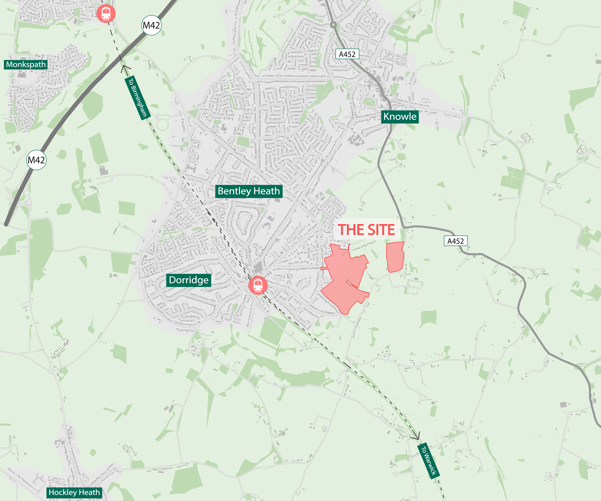
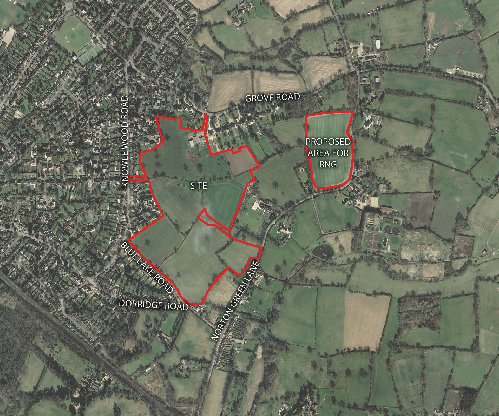
Bloor Homes Logo

Land at Blue Lake
Road, Dorridge

Welcome to our website, where you can discover more information about our emerging proposals for a new residential development on the eastern edge of Dorridge.
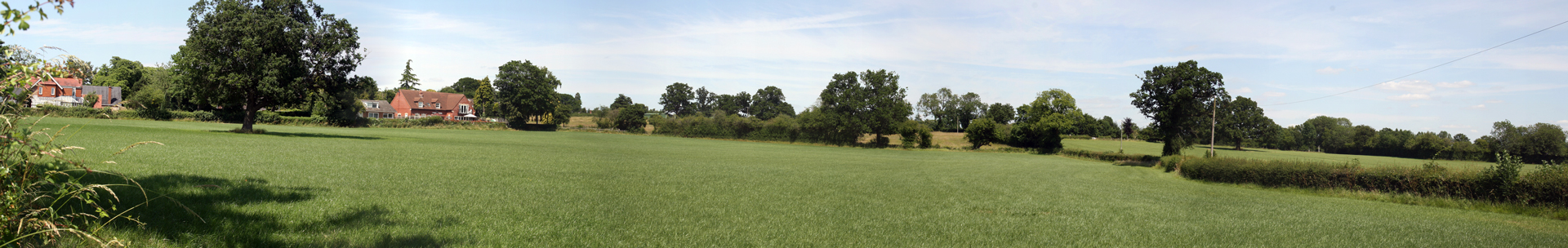
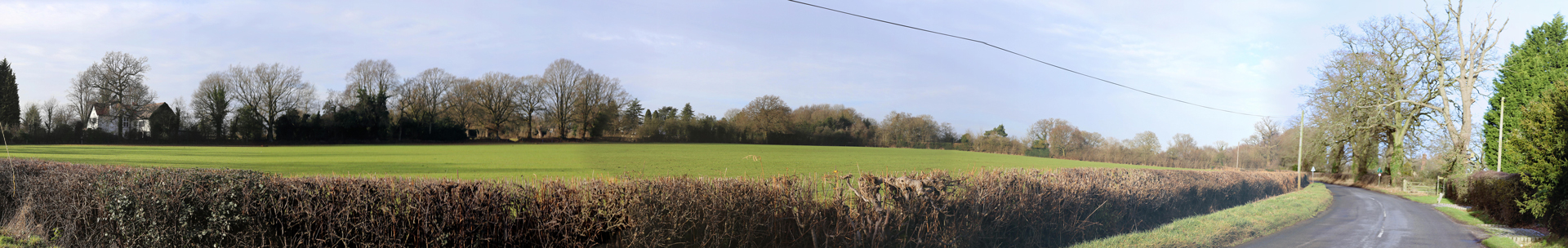
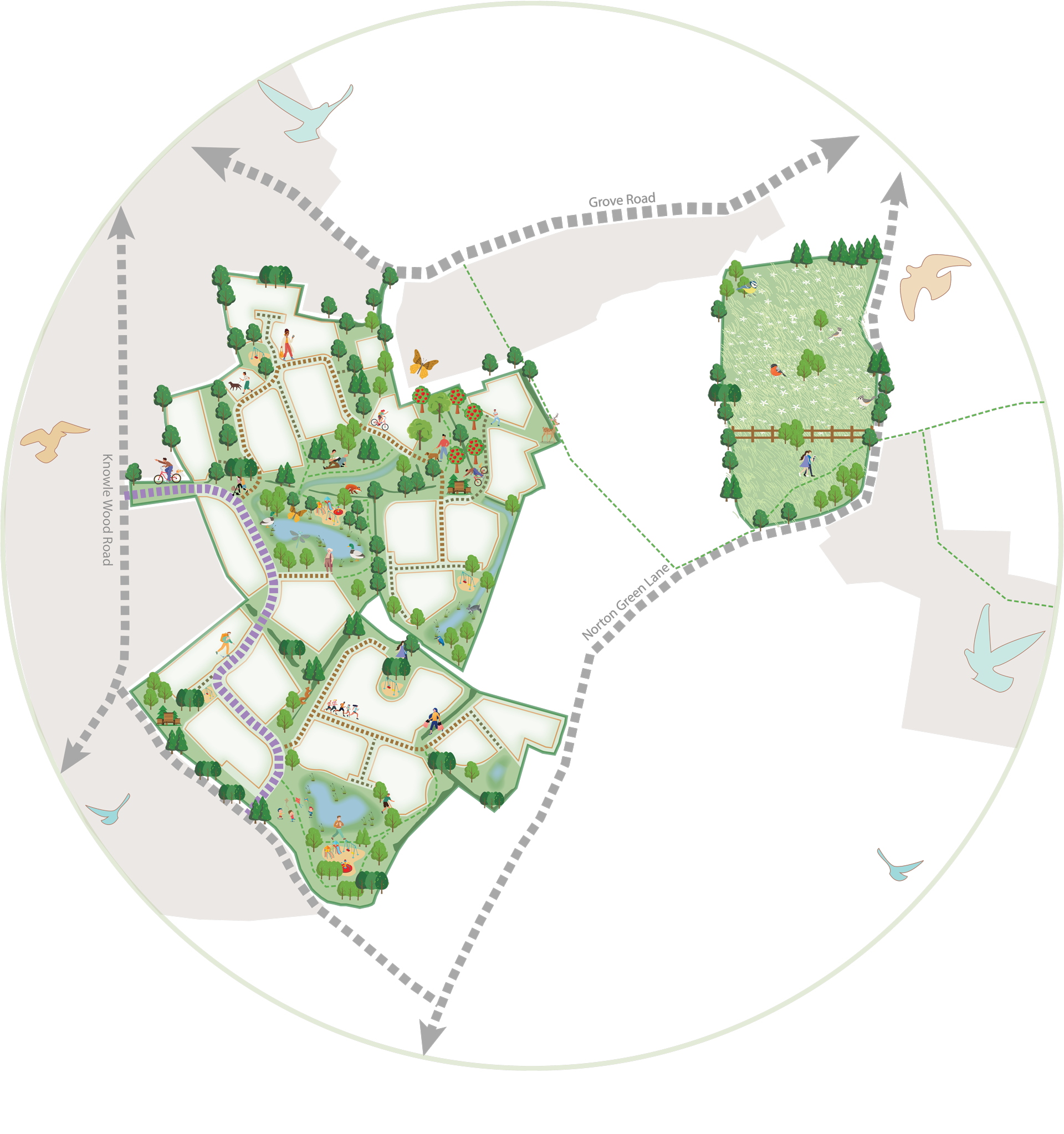
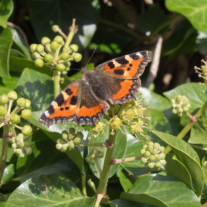
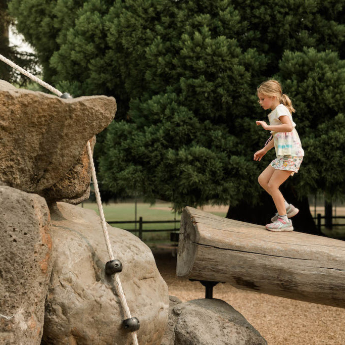
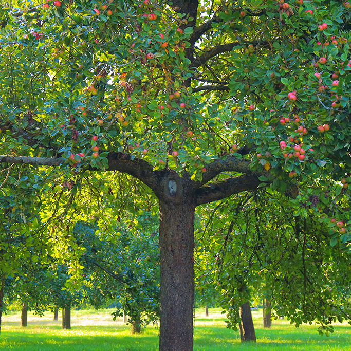
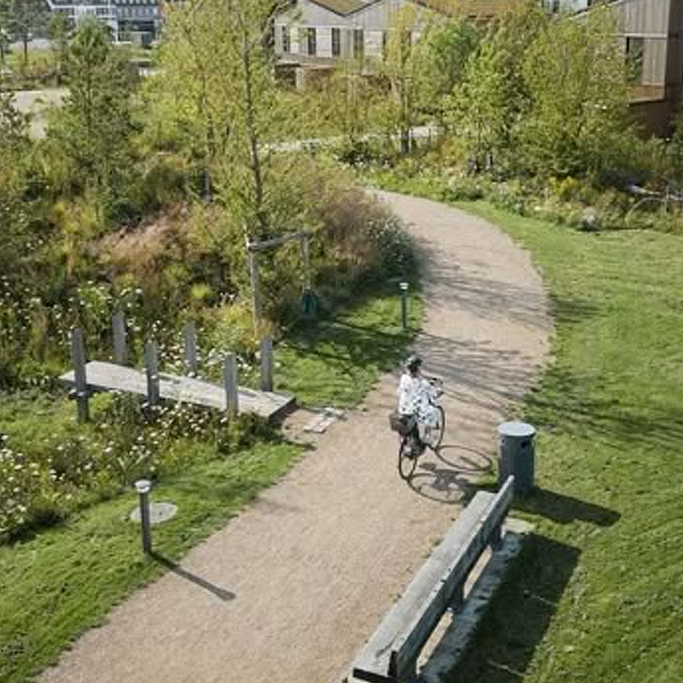
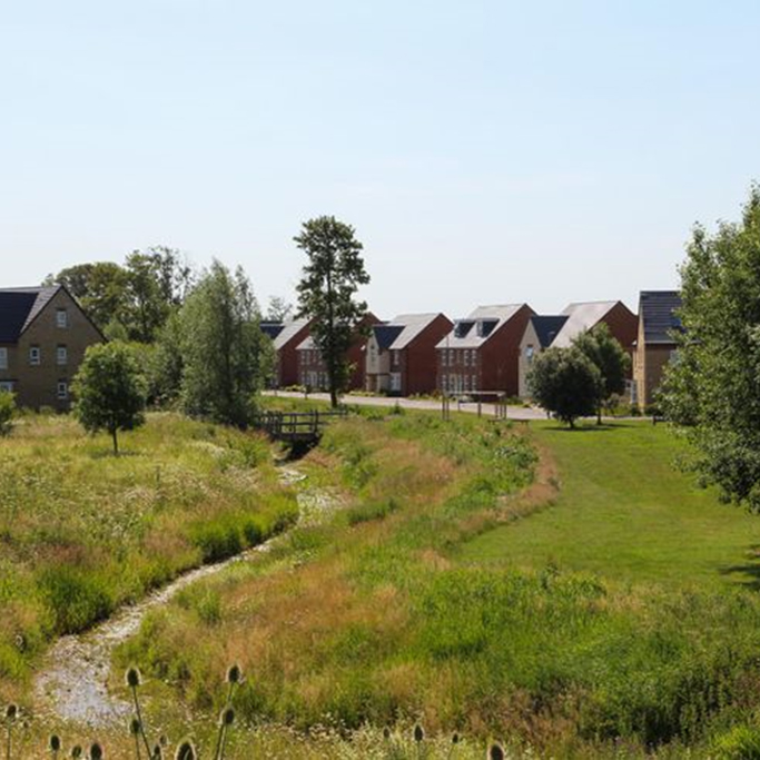
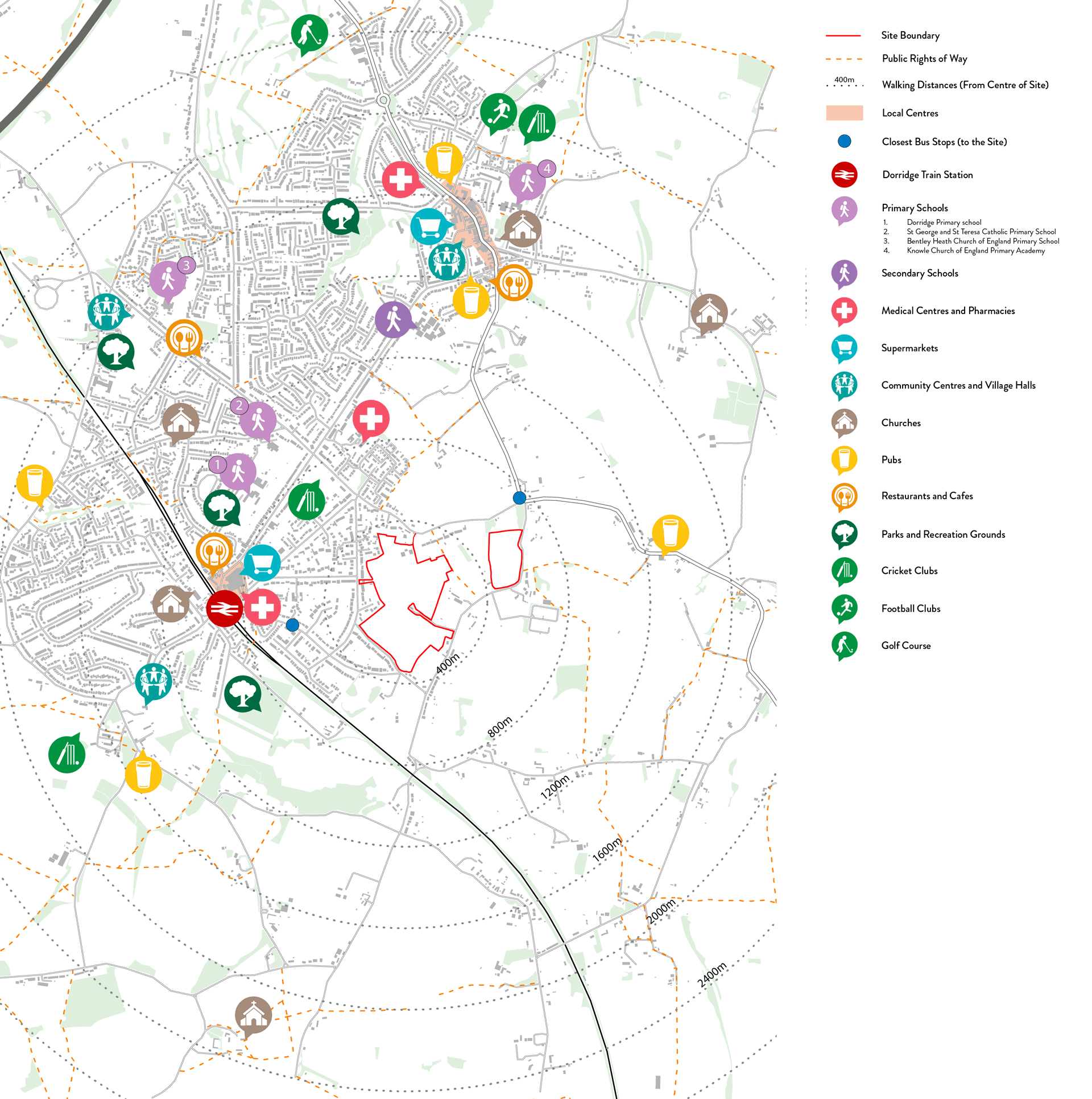
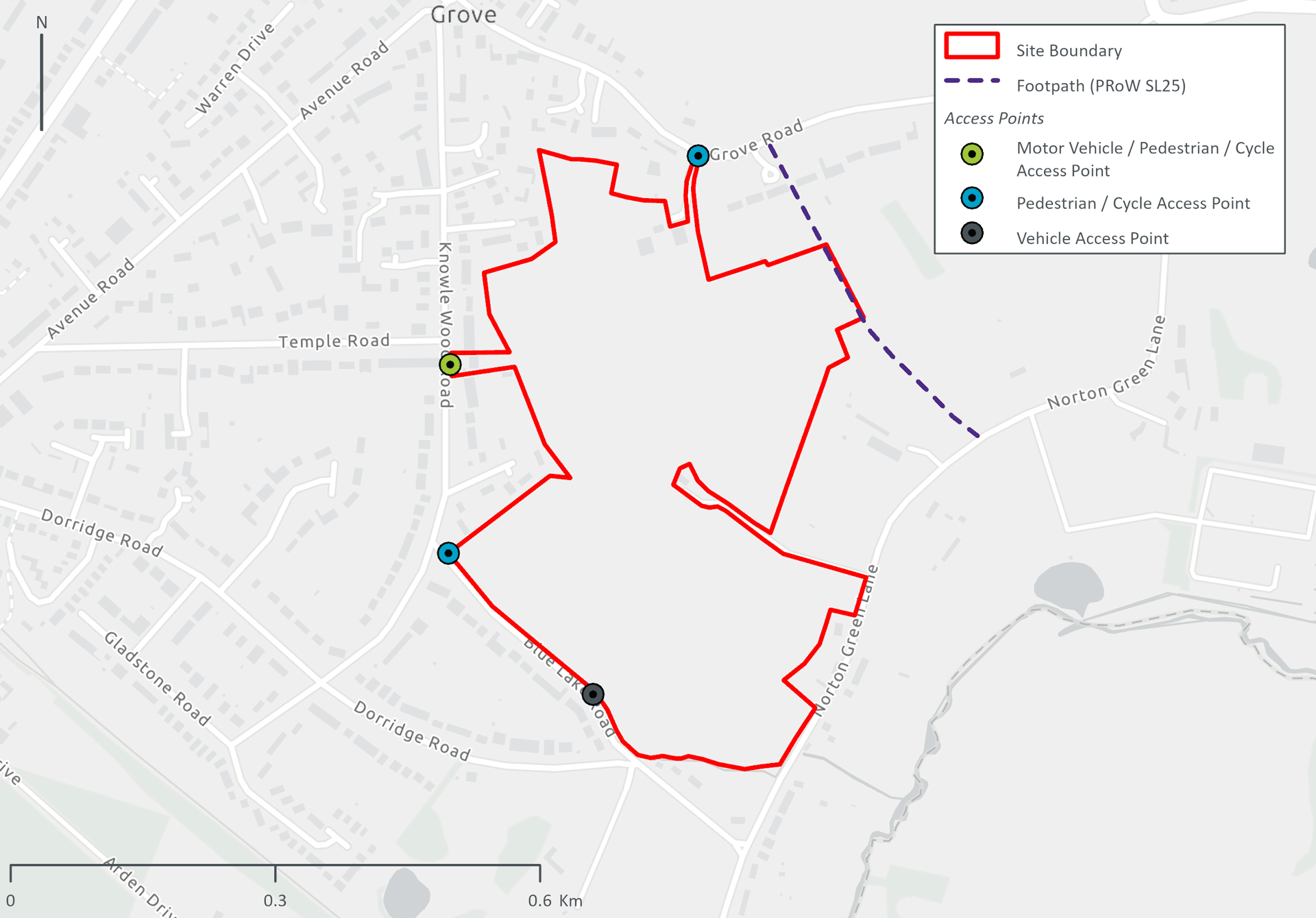
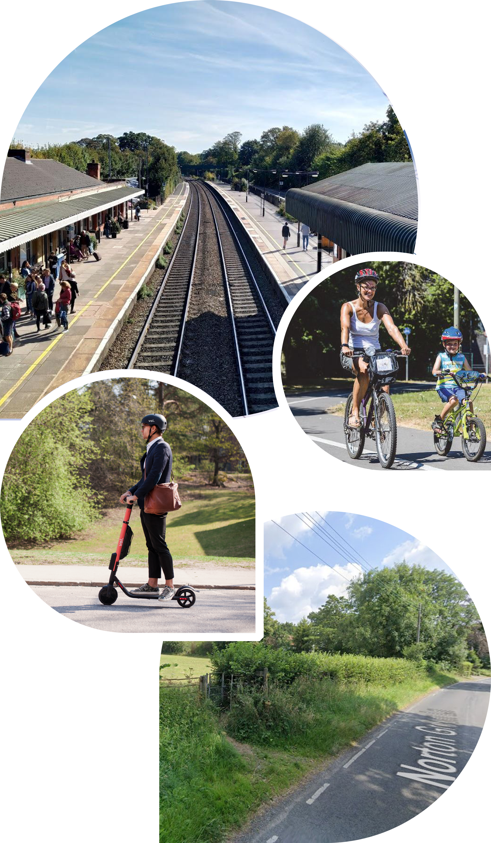
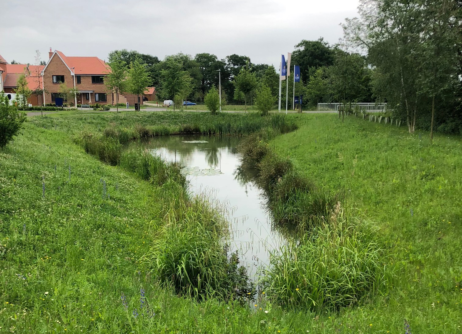
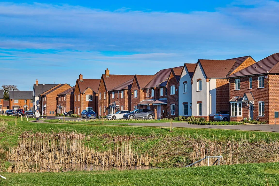
Our emerging proposals for the land at Blue Lake Road, will celebrate and enhance the landscape qualities of the Site to bring forward a sustainable and resilient new development that will help to meet local housing need in a way that is responsive to the surrounding local character. It will be a place where people aspire to live, benefiting from convenient access to key services and amenities and an extensive network of attractive public open spaces.

We recently consulted with the community and held both a Public Webinar with a Q&A session on Thursday 12th June and a Public Exhibition on Friday 20th June 2025. We would like to thank everyone who has shown an interest in our proposals, asked us questions and shared their opinions with us.

You can find information on the scheme we consulted on in the Proposals section and PDF copies of the consultation materials including a recording of the webinar are available in the library section.

If you would like to receive email updates about this project, please sign up to our mailing list using the Register button below.

Location & Background

The Site is located on the south-eastern edge of Dorridge, approximately 1 km from the village centre.

The Site

Dorridge Village Centre is located within 1km of the Site and includes a large Sainsbury's food store, local retail, coffee shops, a doctor's surgery, a dentist and a pharmacy. There are two primary schools in close proximity to the Site, including Dorridge Primary School and St George and Teresa Catholic Primary School. The nearest secondary school is Arden Academy, located approximately 1.2km north of the Site.

Other key facilities accessible to the Site include Arden Medical Centre, Dorridge Park, Knowle & Dorridge Cricket Club and Racquets Club, Bentley Heath Local Centre, and Knowle Village Centre.

In total, the Site is approx. 22.97ha/56.75acres - with 18.68ha/46.15 acres being the main development parcel plus approx.4.29ha/10.6 acres for designated for Biodiversity Net Gain (BNG) - and is currently in agricultural use. The Site has a strong relationship with the existing settlement of Dorridge, by being surrounded by existing housing dwellings to its northern, western, and southern boundaries. The eastern boundary is bounded by agricultural fields with hedgerows along the site boundary.

The additional parcel of land within Bloor Homes' control, located to the east of the main development Site and measuring approx.4.29ha/10.6 acres will be utilised for biodiversity net gain (BNG) in conjunction with the development of the proposals for the Site.

  • Location plan showing site boundary

    Wider site location plan (click to enlarge)

  • Location plan showing site boundary

    Local site location plan (click to enlarge)

View from Blue Lake Road looking east across the Site
View from Norton Green Lake look north towards the Site's eastern parcel

Background

Bloor Homes

Bloor Homes was founded in 1969 by John Bloor and remains privately owned by the Bloor family. We have more than 50 years' experience building high-quality new homes across the country. We give thorough consideration to the communities in which we build to create beautiful places that provide a variety of new homes, while respecting local character, preserving natural amenities and protecting existing wildlife habitats wherever possible.

Bloor Homes has a proven track record of delivering high-quality new homes in the Midlands. We have taken the time to understand the unique characteristics of the site and are committed to creating a thriving community that we would love for ourselves, or our family and friends to live in.

You can find out more about Bloor Homes here >

Collage of bloor homes corporate images

94%

of our homeowners would recommend us

92%

of our homeowners are happy with the build quality of their new homes

90%

of our homeowners enjoyed our home buying process and experience

5-star Home Builders Federation rating for six years

A member of the Homes for Nature scheme

Rated Excellent on Trustpilot with over 3,500+ five-star reviews

The Planning Process

In due course, we will be submitting an Outline Planning application for the Site. We know that sometimes the planning process can be confusing, so we thought it might be helpful if we briefly explained the Outline Planning application process.

An Outline Planning permission establishes the principle of development subject to it meeting certain parameters. The detailed design will then need to adhere to the parameters approved and be subject to a separate Reserved Matters approval at a later date. Solihull Metropolitan Borough Council, as the Local Planning Authority, will therefore maintain control over any subsequent detailed design Reserved Matters applications.

Our Outline Planning application will seek to agree the following parameters:

  • Maximum extent of developable footprint/no build zones.
  • Maximum heights of buildings.
  • Landscape and open space strategy and buffer zone.
  • Density.

Following approval of an Outline Planning Permission, detailed design proposals (in compliance with the parameters) will be prepared and submitted - known as a Reserved Matters application - for approval by Solihull metropolitan Borough Council.

The Reserved Matters application will cover the following elements in full detail:

Final design

  • Site layout.
  • Massing.
  • Appearance and materiality.
  • Boundary treatment e.g. fencing and lighting.

Amenity

  • Car parking.
  • Cycle parking/storage.
  • Bin storage/refuse strategy.
  • Landscaping and open space/play area design.
  • Detailed access and street road design.
  • Design of Pedestrian and cycle routes.
model of a construction of a house

Climate Resilience & Planning Policy Context

The Site will support Solihull Council's green growth aspirations and low carbon vision, which includes tackling climate change, adapting to and mitigating its effects, encouraging residents to live and work locally, encouraging more sustainable travel choices, and securing a net gain in both biodiversity and environmental quality.

Meeting the challenges of Solihull's Climate Change Prospectus will be at the heart of this new development, with a focus on maximising sustainability opportunities, responding to the climate emergency, and incorporating social and economic benefits.

The new development will support the Council's journey towards a low carbon future through an enabling framework that responds positively to the distinctive challenges. This would include:

  • Building new homes to meet high performance standards of energy efficiency, with energy supplied through zero carbon technologies.
  • Enabling passive design techniques that minimise overheating and achieve internal comfort.
  • Protecting and enhancing the value of existing ecological and landscape features to deliver a net gain in biodiversity.
  • Creatively designing nature and green spaces into the development.
  • Locating development where residents will be able to easily and sustainably access everything they need, such as food shops, leisure activities, workplaces and education.
  • Prioritising active and sustainable transport options.
  • Adopting a life-cycle approach to construction.

Placing green growth aspirations at the forefront of the proposals will help to bring the community together through an environment that encourages healthy lifestyles and ensures long-term net gains to biodiversity.

This is a step-change approach to the conventional method of delivering settlement extensions and will ensure that the Site facilitates sustainable outcomes whilst creating a unique place and a legacy for generations to come.

Images of solar panel installation, bus travel, travelling to school and family walking

Solihull's Climate Change and the Low Carbon Vision

Vision Objective Our Commitment
A Prosperous Borough Create an economic environment that supports progressive, innovative businesses to make the transition to a low carbon economy and deliver Solihull's green growth aspirations. The Site is located in a logical and sustainable location for sustainable green growth. Residents will be able to easily and sustainably access everything they need, such as food shops, leisure activities, workplaces, and education. This will help to support the vitality of Dorridge and the wider region economy.
A Smart Low Carbon Borough Develop an efficient and low carbon infrastructure that enables and maximises the opportunity for low carbon growth. Future proposals on the Site will support the Council’s journey towards low carbon growth by prioritising a fossil fuel free development. This will help to achieve zero-carbon aspirations and allow for further reductions of operational emissions as the national grid continues to decarbonise.
A Resource Efficient Borough Improve the energy efficiency of domestic, commercial, and industrial buildings in Solihull to reduce the energy demand required. New homes will be designed to meet high performance standards for energy efficiency, with features including smart energy monitoring and electric vehicle charging points. The design process will also consider building orientation to make the most of passive design techniques that minimise overheating and achieve internal comfort.
An Accessible Borough Efficiently accommodate the future demand for movement. Enhancing Solihull as a sustainable, healthy place to live and work. The Site is advantageously located within a well-connected area that has excellent pedestrian, cycle, and public transport links to significant local and regional destinations. New streets and spaces will be carefully designed to promote active and sustainable travel choices.
A Naturally Healthy Borough Invest in the Borough's natural environment to maximise its benefit to people and wildlife. Understand the risks from climate change and adapt accordingly. The Site will capitalise on the qualities of the existing natural environment to help establish an immediate sense of place and protect and enhance the value of ecological and landscape features to deliver a net gain in biodiversity (BNG).
An Engaged Borough Encourage and enable active participation in sustainability issues – supported by effective communication. The development offers a wide range of sustainability opportunities to meet the needs of existing and future residents. We are committed to engaging proactively and positively with Solihull Metropolitan Borough Council, key stakeholders, and the local community to bring about a shared vision for the Site.

Planning Policy Context

Grey Belt

Grey belt is a new term within the NPPF (December 2024). The site is considered to utilise grey belt land under the Government's definition of grey belt as the land comprises of “previously developed land and/or any other land that, in either case, does not strongly contribute to any of purposes (a), (b), or (d) in paragraph 143. 'Grey belt' excludes land where the application of the policies relating to the areas or assets in footnote 7 of the NPPF, would provide a strong reason for refusing or restricting development.”

Paragraph 155 of the NPPF confirms that the development of homes in the Green Belt should also not be regarded as inappropriate where:

  1. The development would utilise grey belt land and would not fundamentally undermine the purposes (taken together) of the remaining Green Belt across the area of the plan.
  2. There is a demonstrable unmet need for the type of development proposed.
  3. The development would be in a sustainable location, with particular reference to paragraphs 110 and 115 of this Framework.
  4. Where applicable the development proposed meets the 'Golden Rules' requirements set out in paragraphs 156-157.

The proposal is considered to utilise grey belt land that would not fundamentally undermine to the purposes (taken together) of the remaining Green Belt across the area of the plan. There is an identified demonstrable unmet housing need for the type of development proposed in Solihull Borough. The development would be in a sustainable location and would meet the Golden Rules.

National Planning Policy Framework

Green Belt

The NPPF considers Green Belt at paragraphs 142 - 149 and where exceptional circumstances exist, authorities should review Green Belt boundaries in accordance with the policies in the NPPF and propose that alterations to meet these needs in full. Paragraph 145 confirms that Green Belt boundaries should only be altered where exceptional circumstances are fully evidenced and justified through the preparation or updating of plans.

Paragraph 61 seeks to boost the supply of housing and paragraph 72 supports the stance that local authorities should have a clear understanding on land available in their area through the preparation of a strategic housing land availability assessment.

Paragraphs 11 (a) and 11 (b) seek for plans to promote a sustainable pattern of development that seeks to meet the development needs of the area and that strategic policies should provide for objectively assessed needs for housing as well as any needs that cannot be met within neighbouring area.

Achieving Housing Need Targets

The NPPF sets out the Government's new housing targets under the new Standard Method, and Solihull Borough' Local Housing Need figure has risen from 866 to 1,323 dwellings per annum. This increased figure is to ensure the delivery of the Borough's much-needed housing needs, and Birmingham's unmet needs, are not delayed.

Given the increased housing target and Council's previous evidence base, it is likely to require the identification of additional Green Belt land. Our site at Blue Lake Road is well placed to fulfil this need:

  1. Dorridge, alongside Knowle and Bentley Heath is identified in the adopted Local Plan as one of a number of settlements which are a focus for new market housing.
  2. Knowle/Dorridge/Bentley Heath is considered a sustainable settlement with a 'wide range of local services including a secondary school' and the area has 'good links to key employment sites at Blythe Valley Park and Solihull Town Centre.'' It is also 'well served by public transport,'' which provides regular links to Birmingham.
  3. Knowle, Dorridge and Bentley Heath is one of two rural settlements in the Borough that has a full range of facilities including both secondary & primary schools, health services and a range of shops, services, and facilities. As such it is well placed to accommodate growth in excess of just its own local needs.
  4. House prices in the settlement 'are amongst the most expensive in the Borough and affordability continues to be an issue for those seeking access to housing, as does the need to provide a more appropriate range of housing types and sizes to meet future needs.
  5. The site is located a short distance to the centre of Dorridge and is therefore in a very accessible location.
National Planning Policy Framework

Solihull Local Plan

The Solihull Local Plan was adopted in December 2013 and covers the plan period of 2011 - 2028.

In accordance with the NPPF, Solihull Council prepared and submitted a new Local Plan for examination in October 2020. This site was considered and whilst not allocated it was identified as an Amber Site in the Council's consultation in January 2019 - Draft Local Plan Supplementary Consultation: Amber Sites. The Site Selection chapter described the process the Council has undertaken to assess submitted sites. It explained “In carrying out this assessment it should be noted that of the sites that have not been included, some nevertheless performed better than others. As part of this supplementary consultation the Council believe it is useful to identify these 'less harmful' sites (that are shown as amber) so that residents and stakeholders are able to comment on their omission, and whether this is justified.”

The Local Plan was heard at public examination hearings in November 2021. In March 2023, the examination was paused pending updates to the NPPF. Following recommendations by the Inspector and consideration by Full Council, Solihull's Local Plan Review was formally withdrawn in October 2024.

The Council have now started the process of preparing a new Local Plan with a Call for Sites exercise being carried out from Friday 29th November 2024 to Friday 31st January 2025. This resulted in over 300 housing and employment sites being suggested for potential development. The Council have not yet published a draft Local Plan.

Solihull Local Plan

Knowle, Dorridge and Bentley Heath Neighbourhood Plan (2018 - 2033)

The made Neighbourhood Plan sets out a Vision for the future of the Knowle, Dorridge and Benley Heath Neighbourhood Area to 2033, together with the objectives and policies that will guide new development to help achieve that Vision.

Policy H1 of the Neighbourhood plan relates to Housing on allocated and larger sites and acknowledges that additional housing will be built in the Area and that this will most likely come forward through strategic housing allocations in the Solihull Local Plan Review.

Policy H2 relates to affordable housing, with the intention that 25% of all new affordable housing shall be occupied by households with a strong local connection to the Area, both when first built and at the point of any subsequent re occupation.

Knowle, Dorridge and Bentley Heath Neighbourhood Plan

Emerging Proposals

Our emerging masterplan shows where we think the new homes, access routes and public open space could be delivered on the site.

Emerging masterplan showing possible locations of the new homes, public open space, vehicle access and pedestrian and cycle connections
Emerging masterplan showing possible locations of the new homes, public open space, vehicle access and pedestrian and cycle connections (Click to Enlarge)

We are still in the design stage but currently our emerging plans could provide:

  • Up to 350 new energy-efficient homes with low-carbon heating, offering a range of house types, tenures and sizes to suit local housing need, including affordable homes - fully compliant with SMBC policy.
  • Two main vehicle access points via Knowle Wood Road and Blue Lake Road.
  • Access to the Public Right of Way (PRoW) network.
  • Car parking spaces, including reduced mobility and visitor parking spaces - compliant with Solihull Supplementary Planning Document Vehicle Parking Standards and Green Travel Plans (2006).
  • Predominantly 2 and 2 ½ storey - with 3 storeys focused away from existing dwellings.
  • Private gardens and/or amenity space for every home.
  • Provision of multi-functional public open space, natural play and recreational routes - accessible by existing and new residents.
  • Sustainable Drainage Systems (SuDS) and flood alleviation features.
  • EV charging points for every home.
  • A minimum of 10% Biodiversity Net Gain (BNG).
  • Pedestrian and cycle links throughout the Site and connections into the immediate surrounding area.
  • Retention of all significant existing trees and retention of hedgerows, where possible.
  • Safe and easy access to children's play spaces - designed for both young and older children including teenagers.
  • Improved community orchard.

Landscape and Ecology

Promoting healthy lifestyles and wellbeing through connection with nature are key drivers behind the landscape design.

A thoughtfully designed green infrastructure network across the site is focused around the existing mature vegetation. We are committed to providing as large a percentage of Biodiversity Net Gain (BNG) as possible with a minimum of 10%. BNG means that the site's natural environment would be in a better state than before by safeguarding and improving ecosystems.

An additional parcel of land within Bloor Homes' control, located to the east of the Site and measuring approx 4.29ha/10.6 acres will be utilised for BNG in conjunction with the development of the proposals for the Site. This parcel of land will include wildflower meadows to promote biodiversity with part of the southern area being accessible to residents and the local community.

Emerging Landscape Plan
Emerging Landscape Plan (click to enlarge)

We are proposing approximately 8.5ha/22 acres of public open space on the proposed development site with the following features:

Image of british hedgrow

Enhanced Planting

Enhanced planting is proposed throughout the site. Our landscape enhancements throughout the site would create new species-rich meadows with native hedgerows and wildflowers.

Images of child climbing logs

Children's Play Spaces

Play areas will include a range of materials such as boulders and tree stumps to encourage innovative and challenging play for children of all ages.

Images of wild planting

Designated Wildlife Meadow

Wildflower meadows will provide a scenic setting for residents and the local community to enjoy their local landscapes. This will promote biodiversity by providing habits for pollinators such as bees and butterflies.

A community orchard

Community Orchard

The community orchard will contain retained mature trees along with new tree planting. This will give opportunities for residents and the local community to interact with nature and be source of fruits, vegetable and herbs.

Image of public open space

Public Open Space

Will include a range of planting including hedgerows, trees, shrubs and ornamental planting to provide a range of experiences and promote biodiversity.

Naturalised drainage ponds

Naturalised Drainage Ponds

A series of sustainable drainage features such as ponds and lakes will be integrated with green infrastructure such as wetland trees and shrubs to provide greater biodiversity enhancement as part of delivering biodiversity net gain. Some drainage ponds will be publicly accessible for pedestrians to enjoy while others will promote biodiversity.

Access, Sustainable Transport & Connectivity

The Site is advantageously located within an accessible and well-connected area that has excellent pedestrian, cycle, and public transport links to the significant local and regional destinations, including Dorridge Village Centre (within 1km of the site) and Train Station, (approximately 800m from the Site) accessible principally via Temple Road and Dorridge Road, which are highly suitable for walking and cycling. It also benefits from immediate access to the Public Rights of Way network, which provides unique recreational opportunities and direct links to existing amenities and the countryside.

Vehicle Access

Two main vehicle access points via Knowle Wood Road and Blue Lake Road.

  • Vehicle access on Knowle Wood Road will be via a new priority junction located at no. 51 Knowle Wood Road with the existing dwelling to be demolished.
  • Vehicle access on Blue Lake Road will be to the west of Dorridge Road.

Cycle and Pedestrian Access

Pedestrian and cycle access is proposed at the following locations:

  • Knowle Wood Road alongside the vehicle access junction.
  • Blue Lake Road via a pedestrian/cycle only access point at the westernmost corner of the site.
  • Grove Road via a pedestrian/cycle only access point in place of the existing farm access.

Roads that border the Site, including Grove Road, Norton Green Lane and Blue Lake Road, are recognised as 'advisory cycle routes', which form part of a local network of advisory cycle routes that will encourage cycling over shorter car trips.

The Footpath SL25 Public Right of Way (PRoW) runs along the eastern boundary of the site between Grove Road and Norton Green Lane, which the scheme ties into.

Parking Provision

The exact parking quantum will be determined as part of future Reserved Matters applications, but each home will have access to car parking spaces and/or garages. The number of car parking spaces including reduced mobility and visitor spaces will be in full compliance with Solihull Supplementary Planning Document Vehicle Parking Standards and Green Travel Plans (2006). Cycle parking will also be provided in line with the adopted standards, with adequate parking provided for both residents and visitors.

Local facilities plan
Local facilities plan (click to enlarge)
Access Plan
Access Plan (click to enlarge)

Sustainable Transport & Connectivity

Bus

Dorridge is served by a number of existing bus routes, which provide connections to destinations including Solihull, Cheswick Green, and Wythall. The closest bus stop to the Site is located to the south-west on Dorridge Road next to the Rail Station, approximately a 12-minute walk from the Site frontage, serving the A6 bus route. The A6 bus route runs between Solihull and Dorridge via Knowle with a daytime frequency of approximately one bus per hour.

Train

Dorridge Train Station is located approximately 1km from the Site and provides frequent services to destinations including Birmingham New Street, Solihull, Kidderminster, Worcester and London Marylebone. It can be reached in approximately 12 minutes by foot or 2 minutes by bike.

The frequency and range of destinations available, and its close proximity, means that travel by rail from the Site is highly attractive.

Walking/Cycling

The Site is located within close proximity to a number of Public Rights of Way (PRoW), with the opportunity to create new cycle and pedestrian routes within the Site linking into the surrounding countryside and the local centres of Dorridge and Knowle. There are two existing PRoWs crossing the Site.

Images of train station, family cycling, hedgerows and man on electric scooter

Drainage

Surface water drainage

Surface water runoff disposal will be managed through Sustainable Drainage Systems (SuDS) that will mimic the site's existing, pre-development response to rainfall. The system aims to collect, slow down flows, and convey surface water across the site using vegetated conveyance swales allowing for water quality improvement before flowing to the proposed attenuation basins, which will be integrated within the green infrastructure strategy, making attractive features within the open spaces.

SuDS features will be designed to accommodate the design rainfall event (i.e. the 1 in 100-year event with an additional 40% allowance for climate change) to ensure that flood risk will not increase either on-site or off-site due to the development.

Sufficient space for SuDS has been provided within the proposed masterplan which includes several attenuation basins as part of a nature-based SuDS solution which will also deliver biodiversity enhancements through the creation of new habitat features. Control measures to prevent pollution of these ponds and basins will be provided as part of the SuDS strategy.

There will be a new open space in the southern area of the Site, to help alleviate existing local surface water flooding issues, as requested in consultation with the Lead Local Flood Authority (LLFA).

Foul water drainage

It is proposed that the foul sewerage will be delivered through a gravity-based solution - gravity drainage systems operate based on gravitational forces, allowing water to flow from high to lower areas - which will then outfall to the Severn Trent Sewers within the Site.

Flooding

The Environment Agency (EA) Flood Map for Planning demonstrates that the Site is located entirely within Flood Zone 1, which is the most suitable zone for all development types in terms of fluvial flooding. However, there are areas of medium to high surface water risk across the Site which will be managed within the development. There is at very low risk from all other potential sources of flooding – tidal, reservoir, groundwater and sewer.

Indicative image of proposed drainage feature
Illustrative examples of SuDS features

Have Your Say

Thank you for taking the time to explore our website to learn more about the proposed development on Land at Blue Lake Road, Dorridge. The consultation period for submitting your feedback has now closed.

We are currently reviewing your feedback and will be sharing it with the project team, who will be considering the feedback received as they work towards developing the final scheme to be submitted as a planning application to Solihull Metropolitan Borough Council, in due course.

When our Outline Planning Application has been submitted and registered by the Council, there will be another chance for you to have your say on our final scheme. We will update this website and provide information on how you can access the application documents and submit your comments online.

If you haven’t already signed up for updates and would like to be kept up to date with our progress, please leave us your contact details through the feedback form or register here.

Q&A

As with any new development, there are often lots of questions raised by the community. We will continue to add your questions and our responses that arise during our consultation in this section.

We are proposing to build up to 350 new homes, of which between 40% - 50% will be affordable homes, in compliance with SMBC policy and Government guidance.

We are proposing a mix of homes ranging from 2 through to 4 bed homes with most homes being predominantly 2 and 2 ½ storey - with the potential for 3 storeys in the central areas of the site.

We are proposing to create two main vehicle accesses and pedestrian and cycle access points from Knowle Wood Road and Blue Lake Road. A further pedestrian and cycle access point is proposed off Grove Road.

The site is considered to utilise grey belt land under the Government's definition of grey belt, the land comprises of “previously developed land and/or any other land that, in either case, does not strongly contribute to any of purposes (a), (b), or (d) in paragraph 143. 'Grey belt' excludes land where the application of the policies relating to the areas or assets in footnote 7 would provide a strong reason for refusing or restricting development.”

Paragraph 155 of the NPPF confirms that the development of homes in the Green Belt should also not be regarded as inappropriate where:

  1. The development would utilise grey belt land and would not fundamentally undermine the purposes (taken together) of the remaining Green Belt across the area of the plan.
  2. There is a demonstrable unmet need for the type of development proposed.
  3. The development would be in a sustainable location, with particular reference to paragraphs 110 and 115 of this Framework.
  4. Where applicable the development proposed meets the 'Golden Rules' requirements set out in paragraphs 156-157.

The proposal is considered to utilise grey belt land that would not fundamentally undermine to the purposes (taken together) of the remaining Green Belt across the area of the plan. There is an identified demonstrable unmet housing need for the type of development proposed in Solihull Borough. The development would be in a sustainable location and would meet the Golden Rules.

Car parking spaces including reduced mobility and visitor spaces will comply with Solihull's Vehicle Parking Standards and Green Travel Plans SPD (2006) including electric vehicle charging provision.

Contributions to offset any potential impact on local services and facilities will be provided as part of any Section 106 agreement with Solihull Metropolitan Borough Council.

As the developer, we have an obligation to produce a Construction Management Plan, which will be submitted before any construction starts on site for approval by Solihull Metropolitan Borough Council. This document outlines how the construction process will be managed and will stipulate the specific times and routes construction vehicles are allowed to enter and leave the site. We will use the strategic network as far as possible to limit any impact on the local roads and residents.

We are unable to give an exact price range of the proposed new homes at the current time. However, if planning permission is granted and when the homes come forward, they will be comparable in price to new build properties within the local the area.

The NPPF (2024) Glossary definition of affordable housing for planning purposes is: Affordable housing: housing for sale or rent, for those whose needs are not met by the market (including housing that provides a subsidised route to home ownership and/or is for essential local workers); and which complies with one or more of the following definitions 90:

  1. Social Rent: meets all of the following conditions:
    • the rent is set in accordance with the Government's rent policy for Social Rent;
    • the landlord is a registered provider; and
    • it includes provisions to remain at an affordable price for future eligible households, or for the subsidy to be recycled for alternative affordable housing provision.
  2. Other affordable housing for rent: meets all of the following conditions: (a) the rent is set in accordance with the Government's rent policy for Affordable Rent, or is at least 20% below local market rents (including service charges where applicable); (b) the landlord is a registered provider, except where it is included as part of a Build to Rent scheme (in which case the landlord need not be a registered provider); and (c) it includes provisions to remain at an affordable price for future eligible households, or for the subsidy to be recycled for alternative affordable housing provision. For Build to Rent schemes affordable housing for rent is expected to be the normal form of affordable housing provision (and, in this context, is known as Affordable Private Rent).
  3. Discounted market sales housing: is that sold at a discount of at least 20% below local market value. Eligibility is determined with regard to local incomes and local house prices. Provisions should be in place to ensure housing remains at a discount for future eligible households.
  4. Other affordable routes to home ownership: is housing provided for sale that provides a route to ownership for those who could not achieve home ownership through the market. It includes shared ownership, relevant equity loans, other low cost homes for sale (at a price equivalent to at least 20% below local market value) and rent to buy (which includes a period of intermediate rent). Where public grant funding is provided, there should be provisions for the homes to remain at an affordable price for future eligible households, or for any receipts to be recycled for alternative affordable housing provision, or refunded to Government or the relevant authority specified in the funding agreement.
  5. 90 This definition should be read in conjunction with relevant policy contained in the Affordable Homes Update Written Ministerial Statement published on 24 May 2021. As noted in footnote 31, however, the 25% minimum delivery requirement for First Homes no longer applies.

As we are in the early stages and working towards submitting an Outline Planning Application. However, if planning permission is granted, we would anticipate a start on site in 2028, with a site completion in around 5 years from commencement on site.

Vehicle access will be provided with two new priority junctions, one with Knowle Wood Road and the other on Blue Lake Road. These junctions will be a standard 'T-junction', similar to Temple Road junction with Knowle Wood Road. The access junctions will be designed in accordance with relevant design standards to ensure they are safe and sufficient to accommodate the entire development. Drawings of each access junction, along with any key geometries (road widths, visibility etc) will be provided alongside the Transport Assessment. The Transport Assessment will also include detailed capacity assessments of the proposed site access junctions.

All new development proposals are required to involve public consultation ahead of a planning application submission and we are undertaking this process on the site and have made local residents fully aware of the proposals, and we also meet Solihull Borough requirements for public consultation on new development proposals. We will review all feedback received to the public consultation ahead of a planning application submission.

There are three villages and all of them have distinct characters and that’s important for residents that live in each of those villages. This is reinforced by the existing road pattern and the principle roads that connect Station Road for example or Grove Road between those settlements. The site sits behind the properties on Grove Road and we are aware of the other planning applications or decisions being made in and around Dorridge, Knowle and Bentley Heath. Through discussions with the Council we will consider this and present to them as part of our approach and the design approach we would like to take in the context of this site.

We have the Local Plan and a series of recent planning permissions and/or live planning applications that have either been resolved to grant or are currently undetermined. Through the preparation of the planning application we have to consider commitments and cumulative affects and that would include for example traffic. It is considered and scoped with the Council as part of the preparation of this planning application, so it would take into account those existing commitments through discussions with the Council.

The definitions from the Government in the NPPF (National Planning Policy Framework) are available in a separate question. This refers to homes to rent, discounted market sale housing and other forms of home ownership which includes shared ownership, which are the principles of affordable housing. We have the Local Plan and the Neighbourhood Plan and the Council have their own housing needs assessment. It is for us to work through those definitions with the Council and the Neighbourhood Plan Forum and through this negotiation that will determine the type of affordable housing. The intention is to provide a range of dwellings in terms of meeting the identified housing need as important to provide for all age groups in our population. There will be a range of homes from 1 to 4 bedrooms.

The Council are required by Government to have a 5 year housing supply and they do that by bringing forward deliverable sites. At the current time the Council are significantly short of that land supply requirement, their own calculations are 2.13 years so there is a significant shortfall from what they need to provide in terms of housing so there is a need for more housing to be bought forward within the Borough. The intention is to provide a range of dwellings in terms of meeting the identified housing need as important to provide for all age groups in our population. There will be a range of homes from 1 to 4 bedrooms.

The site to the north of Grove road is referred to as the KN2 site and the majority of that site has recently secured a resolution to grant, subject to the completion of planning conditions and a Section 106. Our application has yet to be submitted but once it is, then it will be given full consultation and consideration by the Council. There is the potential for both the sites to come forward but we have not yet submitted our planning application and need to secure a planning permission

On the illustrative masterplan the indicative pedestrian/cycle routes are shown in a pink dotted line. At this stage the detail of the on-site layout and is not faced. This is something we will be looking at as part of the reserved matters application.

As part of our Transport Assessment we will be undertaking a full audit of the highway network in the vicinity of the site, which will include making note of those single sided footways are and where there are any kind of limitations and if there are any drop curve crossing points etc. Through our development proposals we will also take a view to identify areas for improvement. It is very much about finding the balance between improving footways, cycle routes but also access by other uses. This will all form part of our asseement and we will have to demonstrate that anyone who might live on the site can sufficently and safely access local facilities by walking and cycling.

As part of our Transport Assessment we will be undertaking a full audit of the highway network in the vicinity of the site, which will include making note of those single sided footways are and where there are any kind of limitations and if there are any drop curve crossing points etc. Through our development proposals we will also take a view to identify areas for improvement. It is very much about finding the balance between improving footways, cycle routes but also access by other uses. This will all form part of our asseement and we will have to demonstrate that anyone who might live on the site can sufficently and safely access local facilities by walking and cycling.

The first process we undertake is to do digital mapping of a zone of theoretical visibility, which is a process where we model the heights of the proposed development and that sets us a hatched area where the site will theoretically visible. A field assessment is then undertaken to all the areas covered by this zone of theoretical visibility and a series of assessment view points or photographs have been taken that will be included in the Landscape Impact Assessment that will be submitted alongside this planning application. The nature of the landform, the existing mature vegetation and built form does heavily restrict views in to the site.

As part of an Arboricultural survey trees are given a Cat A,B,C or Cat U classification. Cat A and B trees are those considered to be those of the highest value.

It is the quality and condition of the existing compared to the proposed. It is about using the BNG matric and assessing the current base line of what we have on site and how we can enhance that with a greater quality of grassland, native hedgerows, mature trees and how those are maintained over the next 30 years.

In terms of relating that to our site, we have to demonstrate the benefits at this stage that we will bring as part of the outline planning application in terms of habitat creation which relates to BNG, we will set out a network of footpath and cycle routes and indicative areas of play space which will get detailed at reserved matters stage.

As part of our transport assessment we will be looking at the highway network in detail and that will include an assessment of junctions, highways and roads further afield including the routes to the motorway network."

Hydraulic modelling will be undertaken which will enable us to understand any existing surface water flooding and any proposals from this development will not be able to exacerbate that flood extend so will ensure that we are not increasing flood risk to existing residents. Since the flood event measures have carried out including clearance of drains and ditches but also some physical works by the Council but that doesn't prevent the need for us on the site to control the flow of water.

It is not possible to say at this stage what percentage would be social rent but it will be policy compliant as we move forward. This will be something that is discussed with the Council and will form part of the planning application. When it is presented to the planning committee it will be set out.

We are proposing to build up to 350 new homes, of which between 40% - 50% will be affordable homes, in compliance with SMBC policy and Government guidance.

We encourage you to consider the details we are sharing and consulting on. In terms of the process at the point that the planning application is submitted to Solihull Council there will be publicity regarding the planning application, neighbours to the site will be formerly notified and notices put up around the site. There is then a period of consultation of 30 days once the application is registered. For anyone who wants to ask for points of clarification or to comment or object on the application, we would invite those to consider the planning application itself, with all the required documents associated with the planning application which will include flooding and drainage, transport, environmental statement, and green belt asssessment etc. There is is a formal consultation that takes place as part of the planning application process.

We have an education consultant looking at school provision in the area and so we are aware of primary school provision, Arden Academy and schools further afield. So looking at that capacity and pupil generation numbers from the development. We also do a health impact to assess the availability of doctors and access to surgeries that considers this. The health impact assessment is being carried out as part of the planning application and should there be a need for additional school places and/or doctors spaces then as part of the planning application, as you see in other planning applications, there is a request made and the applicants then enter into a Section 106 which is a legal agreement which requires the applicant to provide appropriate contributions to meet any short fall in capacity. This is through he planning application process and that is reported at the point that he planning application would be taken to planning committee.

We have done some initial testing to demonstrate the principle of access from the site. As part of the Transport Assessment we will be doing a full detailed capacity assessment of traffic flows on the local network for the morning and evening peak periods, which include detailed assessment of the key junctions in close proximately to the site including consideration to the local network. Temple Road is a private road and we are not promoting use of the road through as part of the site proposals.

As part of the design and access statement we do a character analysis of the surrounding area and that includes considering materials and architectural features. At outline planning stage we are proposing specific layout or materials for houses but what that will inform is a pallet of materials which will then be represented within the masterplan within various character areas on the masterplan. Solihull Councils urban designer will be heavily involved in the reserved matters planning application stage and will have an influence on the design of the properties that come forward.

We are still working through the BNG process. We are aiming to achieve BNG on site where possible and as much as possible.

We have an education consultant looking at school provision in the area and so we are aware of primary school provision, Arden Academy and schools further afield. So looking at that capacity and pupil generation numbers from the development. We also do a health impact to assess the availability of doctors and access to surgeries that considers this. The health impact assessment is being carried out as part of the planning application and should there be a need for additional school places and/or doctors spaces then as part of the planning application, as you see in other planning applications, there is a request made and the applicants then enter into a Section 106 which is a legal agreement which requires the applicant to provide appropriate contributions to meet any short fall in capacity. This is through the planning application process and S106 details are reported at the point that the planning application would be taken to planning committee.

If permission is granted it will be subject to a Construction Traffic Management Plan and that will specify the timings for construction vehicles and permittable routes for those vehicles. This will, where possible focus on ensuring any construction vehicles stick to the larger road network where possible and will avoid any private roads, like Temple Road.

As part of our Transport Assessment we will be undertaking a full audit of the highway network in the vicinity of the site.

The treatment works down stream of the site, Severn Trent have confirmed that at present they have capacity. The existing fouls sewers that run through the site will go through a consultation phase with Severn Trent to ensure they do have capacity to take the proposed flows from the development.

There is a requirement to manage the proposed habitat for 30 years so that will have to be undertaken by a management company to ensure the condition we have set out in the BNG matrix and the proposed oposed habitats are achieved. Regarding the open spaces and play spaces, there are a number of options and this could include a management company or provision of contributions for the Council to manage and there are examples elsewhere where there are contributions to a Parish Council or Neighbourhood Plan Group to manage. That would be determined but there are a number of options there but principally what is important is that the space is provided and managed in the future and that would be controlled through the S106 agreement and through further discussion with the Council and others.

We have an education consultant looking at school provision in the area and so we are aware of primary school provision, Arden Academy and schools further afield. So looking at that capacity and pupil generation numbers from the development. We also do a health impact to assess the availability of doctors and access to surgeries that considers this. The health impact assessment is being carried out as part of the planning application and should there be a need for additional school places and/or doctors spaces then as part of the planning application, as you see in other planning applications, there is a request made and the applicants then enter into a Section 106 which is a legal agreement which requires the applicant to provide appropriate contributions to meet any short fall in capacity. This is through the planning application process and S106 details are reported at the point that the planning application would be taken to planning committee.

The maximum storey development height will be 3 storeys - which will be focused away from existing dwellings -but predominately 2 to 2.5 storeys - we won't be looking to deliver tall apartment blocks on the site. House types, sizes and location is something that will be looked at in detail at reserved matters stage.

Firstly, we have a Local Plan that is dated 2013 based on a housing figure that pre-dates that. Secondly, we have a Government that is telling local authorities to deliver housing now and in this parliament and thirdly the Council have a requirement to provide a 5 year housing supply and they are significantly short of that and therefore there is a need to supply housing now ahead of a new Local Plan. That new Local Plan is in its early stages and Bloor Homes has engaged in that Local Plan process and will continue to do that but there is a need to deliver homes now and the Local Plan process will take time, with the current timetable suggesting a Regualtion 18 first stage later this year but adoption is not expected until later in 2027. The site proposals deliver new homes and affordable housing, to meet the shortfall in housing land availability in Solihull Borough. As the Local Plan was not progressed and the new Local Plan is commencing there is a need for housing in the short term while the Local Plan progresses and which the application proposals can meet within a 5 year period.

This will be dependent on when the planning application is submitted and registered with the Council. Once the planning application is registered there will be a period of consultation of 30 days. There will be publicity regarding the planning application, neighbours to the site will be formerly notified and notices put up around the site.

It is too early to say what the main component or components will be in the S106. This will be identified through further engagement with the Council and others including departments inside and outside of the Council. The S106 will include provisions for the BNG area and its management and maintenance for 30 years, education contributions and any contributions to public transport, should this be identified by the Council's transport team and affordable housing would also be included. At the point the application is made there will be an indicative list, referred to as 'heads of terms' or S106 items and that will then be through the planning application and consultation process that sits alongside that. That list will then be refined and the final list will be set out in the officers report that will be presented at planning committee for members of the Council to consider.

If permission is granted it will be subject to a Construction Traffic Management Plan and that will specify the timings for construction vehicles and permittable routes for those vehicles. This will, where possible focus on ensuring any construction vehicles stick to the larger road network where possible.

The current proposals do not include the provision of a medical centre. Appropriate S106 contributions will be made as needed.

House type mix will be determined at the detailed planning stage.

The proposed 3 storey buildings will be focused away from existing dwellings. House types, sizes and location is something that will be looked at in detail at reserved matters stage

At this stage we don't have a definitive construction access strategy but this will all be taken into account when it is prepared.

As we are in the early stages and working towards submitting an Outline Planning Application. However, If planning permission is granted, we would anticipate a start on site in 2028, with a site completion in around 5 years from commencement on site.

The development is proposed to be fully electric. We will liaise with the incumbent utility companies at the relevant time to ensure that all utilities are sized accordingly and will be installed in accordance with industry standards. Severn Trent have confirmed that at present they have capacity to serve the proposed development.

When considering the cumulative impact of these sites alongside ours, it will be part of our assessment. As we mentioned the Arden Triangle site does benefit from a permission so we do need to take account of that in all of our work and we are very much considering the impacts of what that scenario looks like in a future year.

People are entitled to travel anywhere on the public highway network. Whilst fully appreciating that people may want to leave the site and primarily travel down Dorridge Road we will considering access onto all kinds of roads around the area. The access location shown has been determined as the best location taking into account site constraints, ecology, attenuation and surface water features.

We are pro-actively engaging with the KDBH Forum and will consider comments that are raised.

We are proposing to build up to 350 new homes, which we are hoping to secure planning consent for.

We are preparing an outline planning application and there is a series of technical studies that are being carried out. We are engaging and consulting with the local community and both the planning and highways teams at the Council and Neighbourhood Forum, with the information available. The technical discussion for the site proposals will continue when the outline planning application is submitted

We had 171 people attend the webinar held on Thursday 12th June 2025.

As this is an outline planning application with all matters reserved apart from access we are sharing all the information that we have available. The consultation period is running for 3 weeks from Monday 9th June to Friday 27th June 2025.

There will be a loss of short sections of hedgerow to facilitate development as the roads go through the site. However, as part of the BNG that is one of the features that we have to propose a 10% increase on, so for every section of hedgerow that is lost there will be a sufficient amount re-established across the site.

The site is significantly smaller than Blythe Valley. Blythe Valley has a more urban context and you have a series of apartment blocks at scale. This site is proposing predominately 2 to 2.5 storeys with maximum 3 storey dwellings so the context of Blythe Valley is different in the sense that there are a large proportion of apartment blocks at scale and a series of dwellings that site alongside it but it is a larger development compared to this site.

With BNG we have to submit our assumptions through the standard matrix, which looks at the current baseline against the proposed baseline and then we have to submit a Landscape and Ecology Management Plan and a Habitat Management Plan which sets out the management regime for a minimum of 30 years which will ensure the establishment of the proposed habitats is set out for the next 30 years.

The definitions from the Government in the NPPF (National Planning Policy Framework) are available in a separate question. This refers to homes to rent, discounted market sale housing and other forms of home ownership which includes shared ownership, which are the principles of affordable housing. We have the Local Plan and the Neighbourhood Plan and the Council have their own housing needs assessment. It is for us to work through those definitions with the Council and the Neighbourhood Plan Forum and through this negotiation that will determine the type of affordable housing.

The site proposals will not promote the use of Temple Road and all application materials will identify the road as a private road.

We will take on board where appropiate feedback is provided. We will still continue with the submission of the outline planning application.

As part of the BNG assessment process the propsoals for the site will deliver 10% BNG on site and off site.

Yes, vehicle, pedestrian and cycle access is proposed via Knowle Wood Road. The proposed junction will be a standard ‘T-junction’ and will be designed in accordance with relevant design standards to ensure it is safe and sufficient to accommodate the development.

Bloor Homes has an option agreement with the landowner.

Drainage will be implemented alongside the proposed residential development through a phased approach.

Foul water flows are proposed to outfall via gravity to the existing Severn Trent Foul Water sewers. Severn Trent have confirmed that at present they have capacity to serve the proposed development. The development is proposed to be fully electric. We will liaise with the incumbent utility companies at the relevant time to ensure that all utilities are sized accordingly and will be installed in accordance with industry standards.

It is the Norton Green Wastewater Treatment Works to the southeast of the Site.

We are proposing that vehicle, pedestrian and cycle access will be off Knowle Wood Road and Blue Lake Road with additional pedestrian and cycle access only off Grove Road, Knowle Wood Road and Blue Lake Road.

Attenuation means attenuation basin which is a drainage pond designed to slow the passage of water from surface runoff to drainage systems during heavy rainfall. It temporarily holds water and gradually releases it to prevent flooding. This helps manage stormwater effectively and reduces the risk of flooding in urban areas.

The application is made in outline and the Master Plan shows the proposed development area and based on average density of 37 dwellings per hectare, the site has a capacity for 350 new homes. The detailed site layout will follow at the Reserved Matters planning stage.

Blue Lake Road and the capacity of local junctions will be assessed within the Transport Assessment to be submitted with the outline application. Discussions are ongoing with SMBC highways as part of the applciation process.

Consideration to use of public transport by new and existing residents will be made within the Transport Assessment and any potential improvements will be met by appropriate S106 contributions towards existing infrastructure/services discussed and agreed with SMBC highways as part of the outline application process.

As part of the Transport Assessment a detailed assessment of anticipated traffic volumes associated with the proposals will be undertaken. This will include consideration of traffic volumes at the site access junctions and a number of junctions in the local area. Consideration will also be given to the combined effect of the application proposals alongside the Arden Triangle development.

The site proposals deliver new homes and affordable housing, to meet the shortfall in housing land availability in Solihull Borough. As the Local Plan was not progressed and the new Local Plan is commencing there is a need for housing in the short term while the Local Plan progresses and which the application propsoals can meet within a 5 year period.

The Transport Assessment will consider the impact of development traffic and nearby committed developments on the surrounding highway network which will include Dorridge Centre. Consideration will be given to appropriate and achievable mitigation measures where necessary.

The proposed average density is 37dph (dwellings per hectare) for the outline application proposals.

If the calculated sound pressure level at all assessment positions is not equal to or lower than 37.0 dB(A) then the heat pump will not comply with the permitted development noise limit, and it is not then at an acceptable noise level. However, Bloor Homes will use air source heat pumps that adhere with permitted development noise levels.

As part of the planning application, a Travel Plan will be submitted which will set out various travel-related measures and strategies that will be implemented to encourage users of the site to consider the use of sustainable travel modes and seek to reduce car use. This will be complemented by the sustainable transport strategy which will seek to improve access to public transport, pedestrian and cycle routes to key destinations.

The Transport Assessment will consider the impact of development traffic on the local highway network based on current travel behaviours to ensure a robust assessment of the highway network.

How can you commit to a 10% biodiversity net gain when you are developing 81% of the site, which is 'green' land? As part of the BNG assessment process the proposals for the site will deliver 10% BNG on site and off site.

BNG Habitats are created through the site in appropriate locations as shown by the Master plan and off-site.

It is expected that the energy approach for the development will be an all-electric, heat-pump led strategy. This will include technical assessment at detailed design stage to quantify the energy demand of the dwellings, and then to specify low and zero carbon technologies to meet the forecast demand, for the supply of heat, light, and power. In most cases, it is anticipated that the strategy will include air source heat pumps and solar PV panels. Utilising an all-electric strategy means that the dwellings are ‘net zero carbon ready’ and will become net zero carbon in operation without the need for retrofit, at the point when the UK electricity grid decarbonises. This is currently forecast for 2030.

Quantification of the amount of PV required will be determined at detailed design stage and is influenced by factors such as building orientation and size. It should be noted, there is a forthcoming update to Building Regulations, known as the Future Homes Standard. Whilst the update has not yet been published, it is expected that this will include the use of Solar PV panels in most cases.

The implementation of a 20mph speed limit is not currently proposed on local roads surrounding the site. Further discussion will also be had with SMBC Highways.

The proposed What consideration is given to light pollution in what is currently a fairly dark site and what sort of lighting is envisaged?access points are located to the north, west, and south of the site to tie into existing road infrastructure. Consideration has been given to the existing infrastructure, key desire lines, connectivity to local amenities for residents and constraints.

Artificial lighting will be located along the roads and pathways within the Site, which will provide illumination for the safe movement of pedestrians and vehicles. It is envisioned that domestic lighting will also be present at the front and rear of the residential properties.

All lighting on site will be of a warm correlated colour temperature (CCT). Warm CCT – typically 3000K or less – produces a softer, amber toned light that is less harsh and overwhelming than cool or bright-white lighting. This will help to reduce glare, is better for wildlife and helps maintain the natural nighttime environment, whilst still providing safe and effective lighting.

The lighting on site will be fixed so that it is aiming directly downwards and will utilise shielding and/or hoods to control the spread of light so that it does not impact residential or ecological receptors. Uplighting shall be avoided.

Domestic/residential lighting will be activated via motion control and will deactivate after a set period if no further movement is detected.

There are green corridors through the site proposals that can be used by wildlife.

Solihull Council currently has a significant undersupply of housing land and in future years will still need to meet generated housing need.

The OS data has not yet been updated with the resident’s new property on Grove Road. However, as requested by the resident, we have indicatively added the house to the OS base, based on what we could see from the aerial photos, which gives an indicative idea of the approximate extent and scale of the property on the base maps. We have updated the aerial view from google earth to include this property as requested by the resident, so the property is visible on the emerging masterplan and this has also been updated on the consultation website.

If planning permission were to be granted for the development, it would be subject to a condition that a Construction Traffic Management Plan (CTMP) will be submitted and approved by SMBC prior to any construction works being undertaken. This will include details regarding the routes construction traffic will be required to take, access and compound locations, delivery timings, and mitigating any potential impact of construction traffic on nearby roads. The CTMP will be developed by construction experts alongside the developers and construction team.

The Transport Assessment will provide an overview of the detail that the Construction Traffic Management Plan will likely include, including identification of potential routes.

Timeline

Throughout the pre-application planning process, we will be in ongoing discussions with planning officers and stakeholders, including the local community, about our emerging proposals to develop the site. The timings set out below are indicative dates only and will be subject to change as we progress through the design and planning process.

  • Monday 9th June 2025 Start of consultation period
  • Thursday 12th June 2025 Public Webinar and Q&A session
  • Friday 20th June 2025 Public Exhibition at Dorridge Village Hall
  • Friday 27th June 2025 Deadline for comments. Consultation period closes at midnight
  • Mid/Late Summer 2025 Submission of planning application to Solihull Council
  • Winter 2025 Expected determination of planning application by Solihull Council

Dates of submission and determination are indicative only and will be subject to change.

Library

Contact

If you have any questions, would like some more information or need some help, please do get in touch with the Community Engagement Team:

Send us a message and we will get back to you as soon as we can:

landatbluelakeroad@KGCommunications.co.uk

By Phone

If you want to chat to a member of the team, give us a call:

07909 735417
(Monday to Friday – 9.30am to 5pm)